Hang En, located in Phong Nha–Ke Bang National Park in Quang Binh Province, is the world’s third-largest cave, stretching over 1.6 km. It is renowned for its विशाल cavern dome, a stunning campsite beside an underground river, and tens of thousands of swallows inhabiting the cave. It is also an important stop on the journey to explore Son Doong Cave.
Special features of Hang En
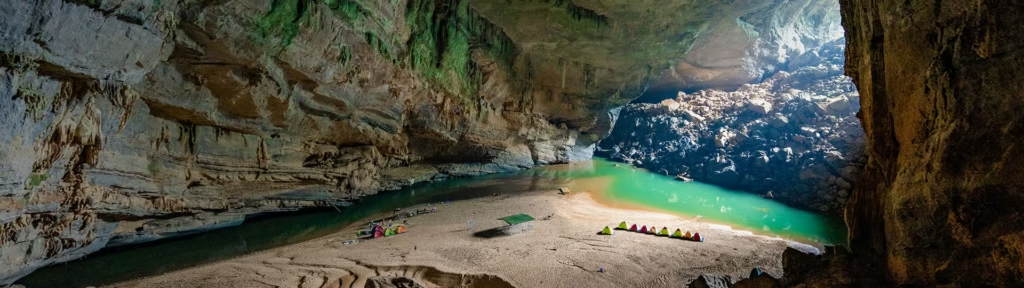
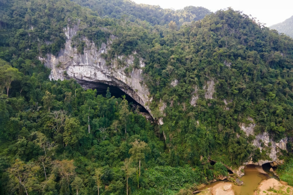
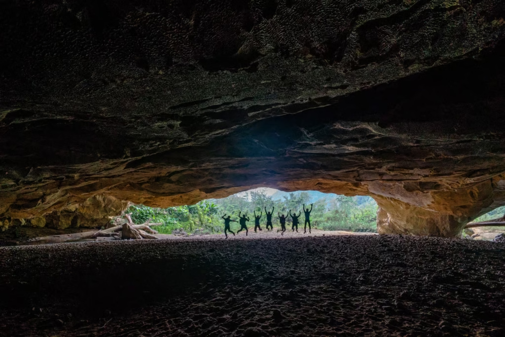
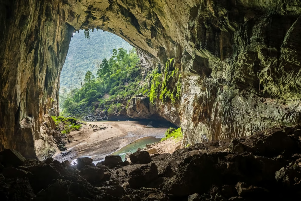
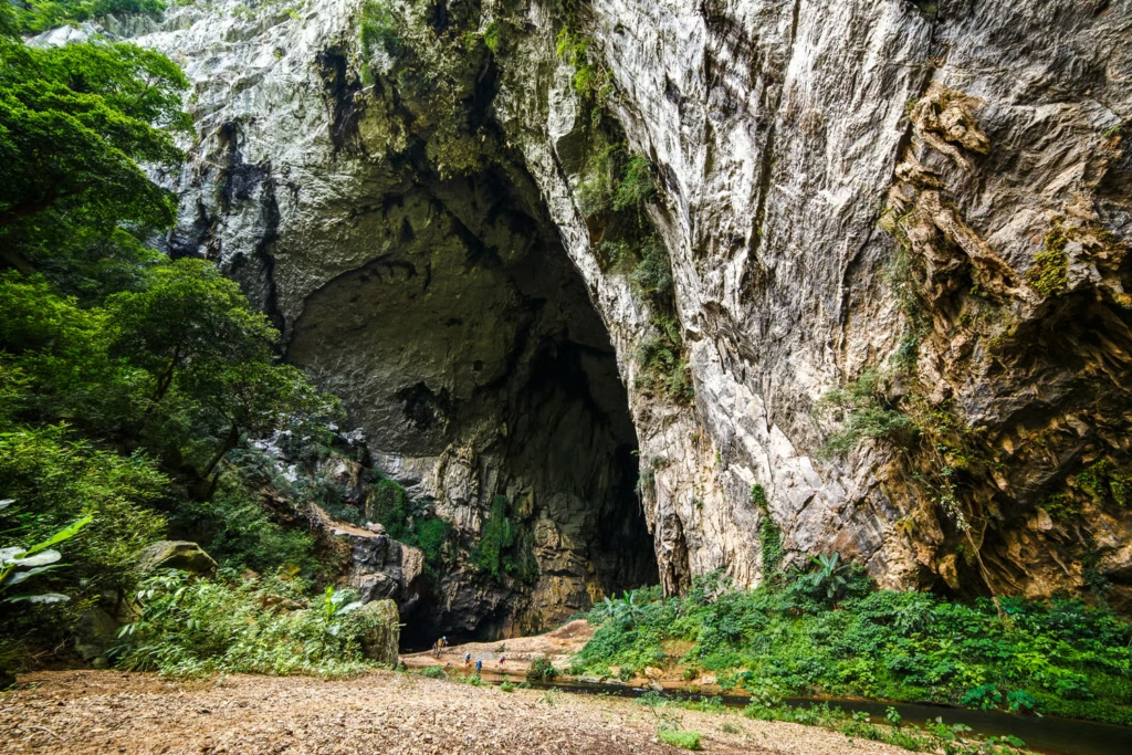
👉 Massive size: The cave stretches over 1.6 km with three entrances. In some places, the ceiling reaches up to 100 meters high and 170 meters wide—large enough to fit a Boeing aircraft.
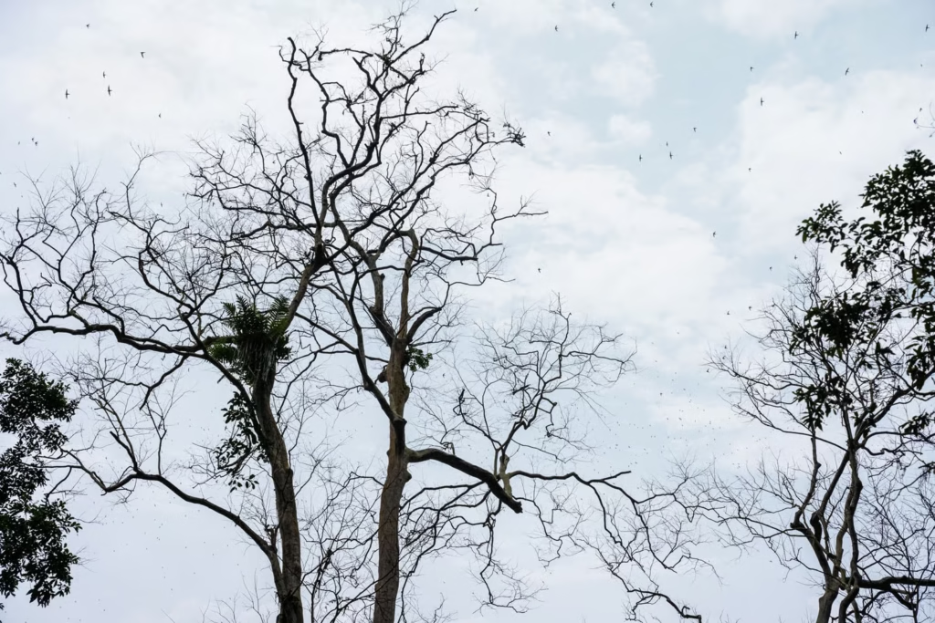
👉 Unique name: The cave gets its name from the millions of swallows that nest and live here.
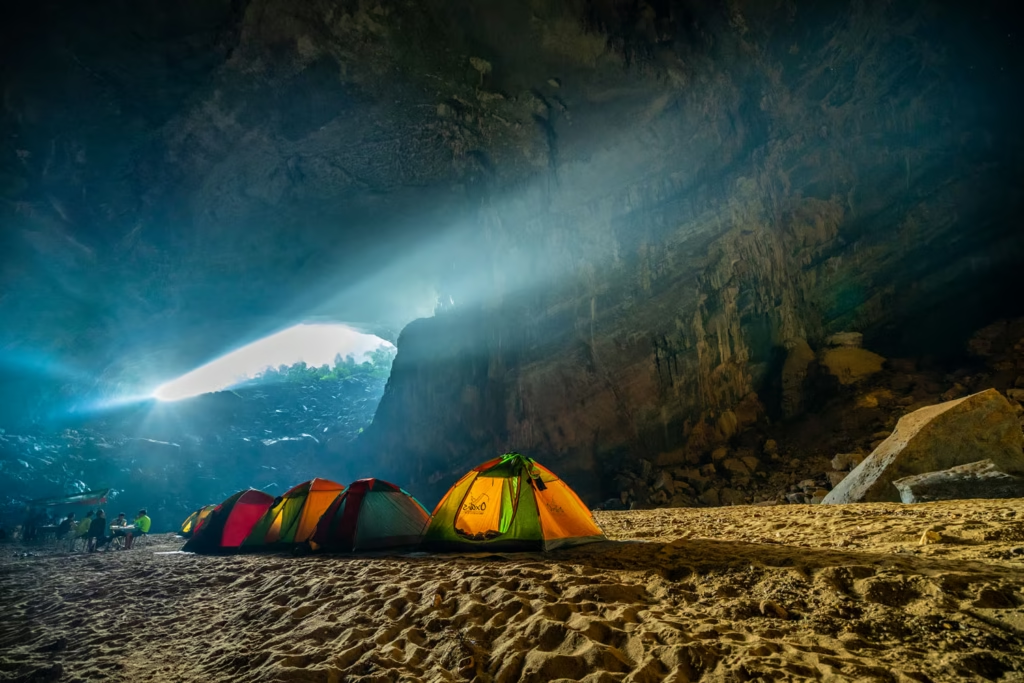
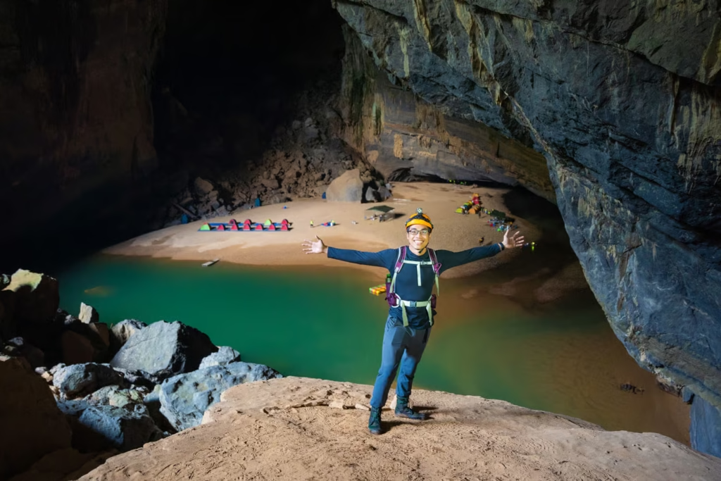
👉 Diverse ecosystem: Inside the cave, the Rào Thương River flows through, creating soft sandy beaches and emerald-green pools right at the campsite.
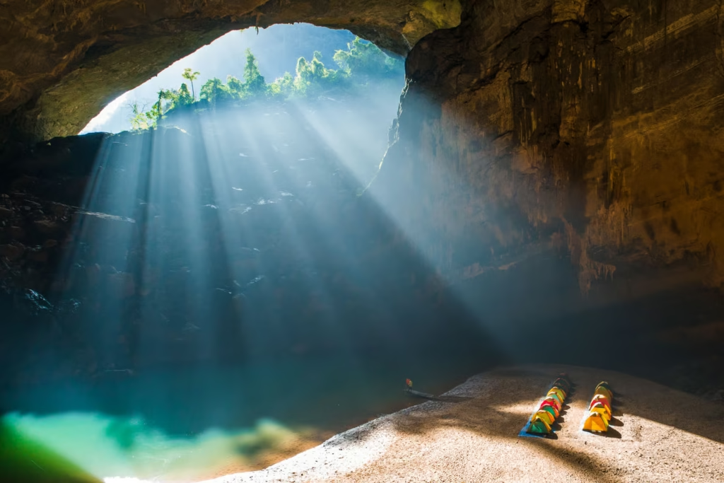
👉 Natural phenomenon: From around December to February, visitors can experience the “sun-hunting season,” when sunlight beams shine through the cave entrances, creating a magical and surreal scene.
History of discovery and origin of the name Hang En
The origin of the name
With its high cliffs and wide floor, Hang En Cave in Quang Binh Province has long been a haven for hundreds of thousands of swifts during their nesting season. The spectacle each evening or early morning of streams of swifts returning from or heading out to feed is an amazing sight. The name originated from the fact that this large cave was a nesting habitat for thousands of swifts, and the local people named the cave after this bird species.
The history of discovery
Hang En was known to the Arem people hundreds of years ago when their ancestors took the cave as a place to live. With a nomadic lifestyle, the Arem people lived in caves and moved seasonally based on available food sources from nature such as hunting and gathering seasons. En Cave is a giant cave, with thousands of swift’s nests on the ceiling of the cave, thanks to their small and agile physique, the Arem people have amazing climbing skills. They cut many small, strong tree branches, sticking them into small rock holes or using jungle rattan, or vines tied together to create natural ladders which they then used to climb up to the ceiling of the cave to catch birds. This is a method they’ve been using for a long time to catch swifts.
From time immemorial, the swift is considered the main source of food and nutrition of the Arem people. Therefore, the condition for the Arem boys to get married was to climb the ceiling of the caves by themselves to catch the swifts, affirming their ability to feed their families.
In recent years, with support from their home province, the Arem people have settled in permanent villages and no longer live a nomadic lifestyle or climb high cliffs to catch swifts as before. Instead, they cultivate fields like other locals. However, every June, they still maintain the tradition of going into caves to collect young swifts that have fallen from their nests as they learn to fly. It is a way for them to remember their roots and preserve their cultural traditions and practices.
Ho Khanh also learned about Hang En in 1990 during his journey to search for precious fragrant wood. It wasn’t until 1994 that cave experts from the British – Vietnamese Cave Exploration Team came to survey and measure Hang En that it became widely known to many people both in Vietnam and around the world.
The process of surveying Hang En
Hang En Cave is located in the core zone of Phong Nha – Ke Bang National Park, about 11km from the 35th kilometer of the Ho Chi Minh Highway western branch. With a large cave entrance, Hang En has been recognized by the local people around this area for many years.
In 1994: During the third expedition to Phong Nha Ke Bang, the British – Vietnamese Cave Exploration Team explored and mapped En Cave.
In 1994, the experts had to hike for three days from Phong Nha on Quyet Thang Road to reach the entrance.
Hang En Cave is located at an altitude of about 180m above sea level and is one of the main sinks of the Phong Nha Cave System. The Rao Thuong River flows through Hang En Cave and merges with the stream from Khe Ry Cave and disappears underground in a rock collapse. Having also explored the resurgence cave for this river which is 5km away, the team knew there should be a cave connecting the two. This turned out to be Son Doong Cave – a famous one with an underground river system in Vietnam.
During the survey, exploration, and measurement of Son Doong Cave, Hang En was also used as a campsite and base from which to explore.
The survey shows that Hang En has a total length of over 1.6km, a volume of up to 6.7 million cubic meters. The widest passage is about 200m, with a 145m high ceiling, and a height of 120m and width of 110m at the exit. Hang En is considered by the cavers to be one of the largest caves in the world. Belonging to a karst landscape in Vietnam, Hang En is one entrance to the Phong Nha Cave System and the gateway to Son Doong Cave.
Ban Doong Village and Arem people
Ban Doong Village
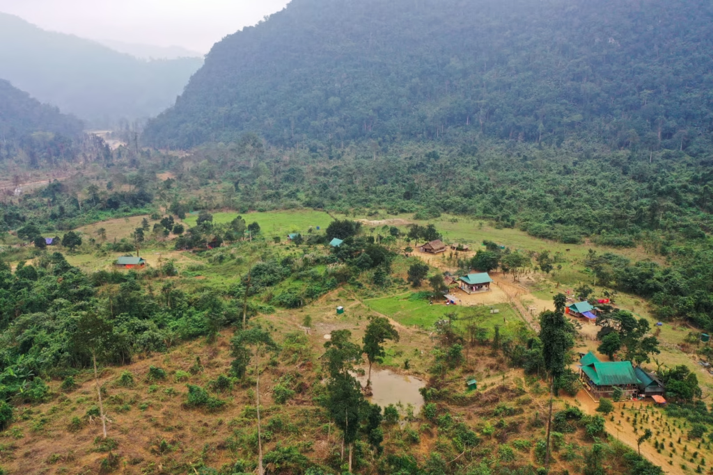
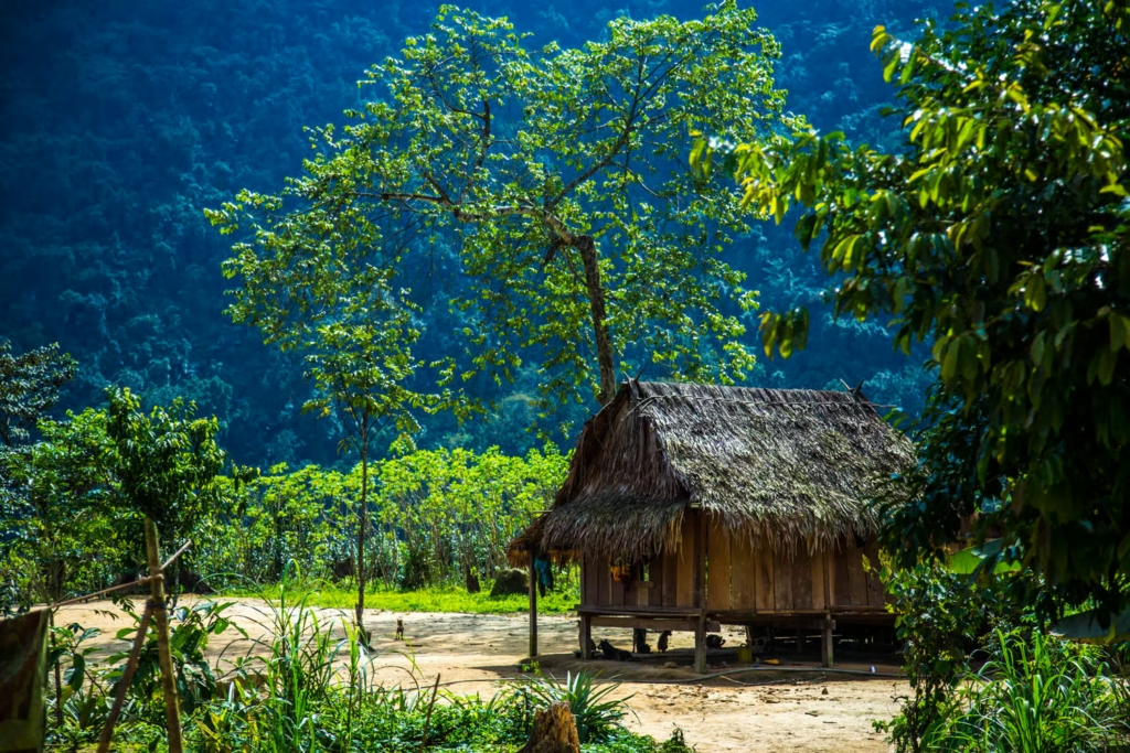
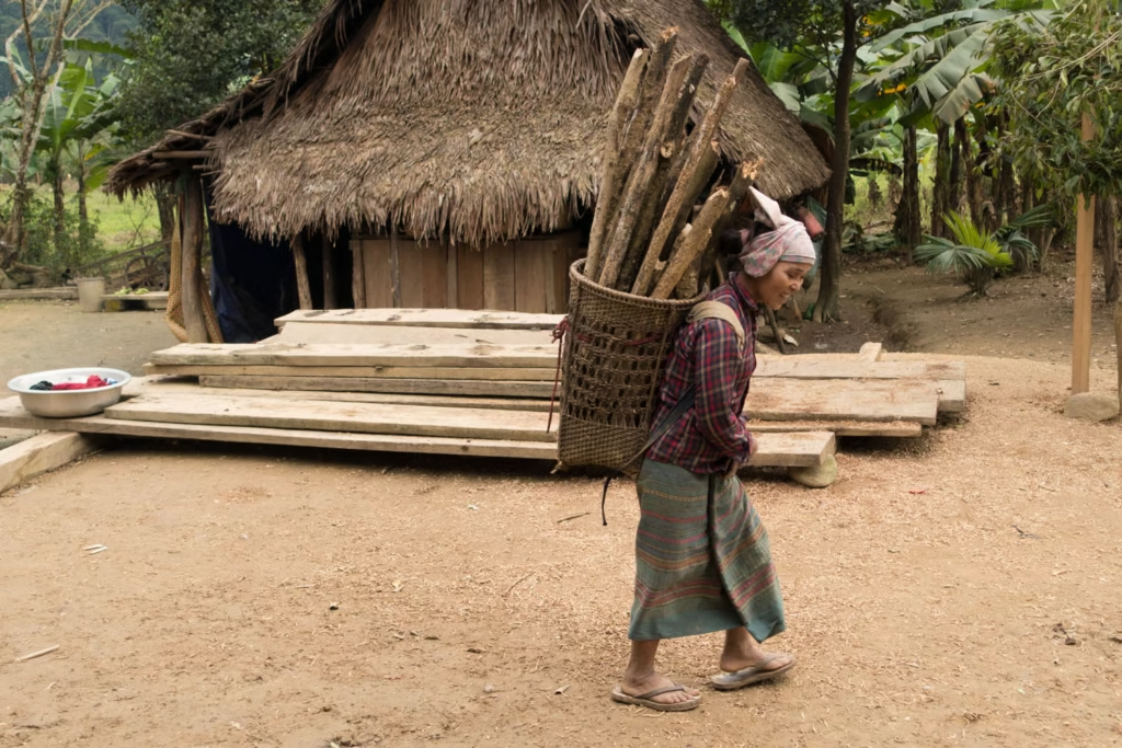
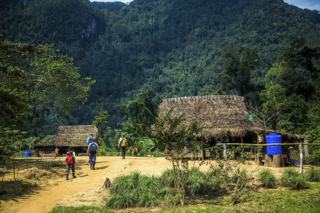
Ban Doong Village was established in 1992 by a group of Bru – Van Kieu people who migrated from the Quang Ninh District, Quang Binh Province to the Hung Doong (Hung means valley) area to settle after their village faced a big flood. Ban Doong is located in the remote area in the middle of the primary rainforest in the Phong Nha – Ke Bang National Park. Initially, there were only 5 people in Ban Doong, but today (2022) there are 12 households with 52 residents. The lives of the Ban Doong people still maintain the traditional aspects of the Bru – Van Kieu ethnic group. During the Hang En Cave trek, to reach to Hang En Cave, one must go through Ban Doong, home of the Bru – Van Kieu ethnic people. Visitors will stop here for lunch and experience local food in Quang Binh. This is considered as one of the highlights of trekking tours in Vietnam.
Arem people 39 Village
The Doong Valley, Hang En, and Ruc (39 village), known previously as Ban Area, was the area of the nomadic Arem ethnic group, which belongs to the Chut ethnic minority. Previously, the Arem people moved around the forests (now part of Phong Nha – Ke Bang National Park) for their livelihood, primarily through hunting and foraging. They didn’t have a permanent home and usually lived in caves and caught birds for food. Today, the remains of these vines used for climbing are still preserved at the main chamber and exit of Hang En.
Geology and geomorphology of Hang En
Geology of Hang En Cave: Located on a similar geological faultline as Hang Son Doong, Hang En is also located in the oldest karst mountain system in Asia, formed about 400 – 450 million years ago. Like Hang Son Doong, it is likely that Hang En Cave is relatively young, with an age of 2 – 3 million years.
Hang En was formed by the flow of the Rao Thuong River through the large Hung Doong Valley. This river flowed through a range of karst mountains, eroding the karst layer and forming Hang En. This erosion process takes place very slowly, so it may take thousands or even millions of years to see the result.
Geomorphology of Hang En Cave: It has three entrances, the large entrance is the entrance that was formed first and is the entrance where sunbeams may be seen from December to March. The small entrance is the usual entrance to the cave and the exit has a high and wide cave opening. From the exit of the cave, following the river valley for 3km and climbing a short hill will lead to Son Doong Cave.
The ecosystem inside the cave
Located in the core zone of Phong Nha – Ke Bang National Park, Hang En Cave weather conditions is also greatly affected by the Phong Nha climate. Generally, the weather inside Hang En is not much different from the outside, with temperatures ranging from 20 – 25°C. Some species of animals find the conditions inside the cave to be a suitable habitat. At the large entrance and the exit of Hang En, some species of squirrels, monkeys, and langurs may be seen. During dusk, some flying foxes also often hunt in this area. On the high ceiling of the big chamber where the campsite is located, and at the high exit, many swifts choose to build their nests.
In the middle of the cave, where the light is limited, it is ideal for bats in Hang En Cave. On the cave floor, there are many species of centipedes, pseudoscorpions and other insect species.
About the biodiversity of Hang En Cave, deep inside the cave, due to the lack of light, almost no plants can be found. However, in areas close to the daylight, such as at the entrances and the exit of the cave, some species of plants like moss, algae or fungi can be seen. At the exit of the cave, there is a species of plant growing on the cliff and hanging down from the ceiling of the cave.
Trekking and visiting information
👉 Best time to visit: From March to August each year. This is the dry season in Quảng Bình, with favorable weather for stream crossing and jungle trekking.
👉 Difficulty level: Rated as moderate, suitable for those who enjoy physical activities but do not require professional climbing skills.
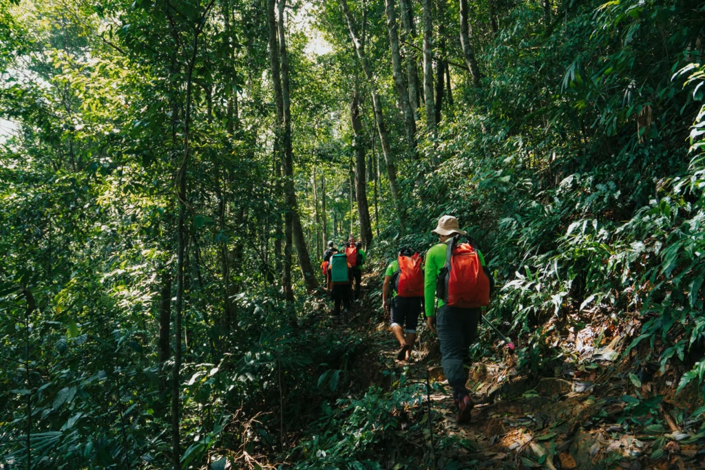
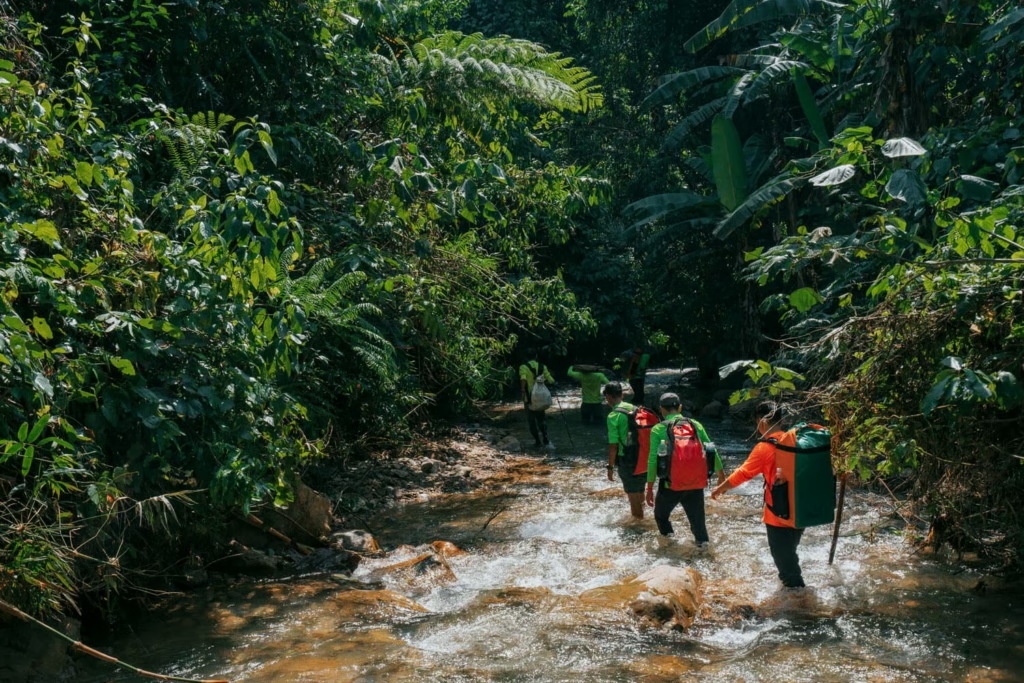
👉 Itinerary: Typically lasts 2 days and 1 night. Visitors need to trek 11km through the, cross hills, and wade through streams to reach the cave.
👉 Tour operator: Oxalis Adventure is the only company licensed to operate professional expedition tours here.
Source (in part): https://oxalisadventure.com/
To make your journey to conquer Hang En Cave as smooth as possible, you can refer to the basic itinerary and the essential ‘must-have’ items below:
2 Days 1 Night Tour Itinerary (Reference)
Day 1: Dong Hoi – Ban Doong – Hang En
- Morning: Pick-up in Dong Hoi, transfer to the trekking starting point.
- Noon: Descend about 350 meters and have lunch at Ban Doong (a small village of the Van Kieu people deep in the forest).
- Afternoon: Cross multiple streams along the Rao Thuong Valley to reach the entrance of Hang En.
- Evening: Camp overnight, swim in the cave’s natural pool, and enjoy dinner prepared by the porter team.
Day 2: Cave Exploration – Return
- Morning: Climb to the highest point inside the cave for a panoramic view of the campsite, then pass through the back exit of the cave (facing the route to Sơn Đoòng).
- Noon: Have lunch by the stream.
- Afternoon: Trek back along the same route, with the most challenging part being the final 350-meter uphill climb to reach the main road. Vehicle transfer back to Dong Hoi.”**
Packing List for the Trip
Since this is an adventure tour, you should prioritize lightweight and quick-drying items:
Trekking clothing:
- 1 pair of long pants and 1 long-sleeve shirt (lightweight, quick-drying) to avoid scratches and insects.
- 1 set of comfortable clothes to change into at the campsite.
Footwear: Very important. Choose shoes with good grip and quick drainage (as you will frequently walk through streams).
Personal items:
- High socks, mosquito repellent, and sunscreen.
- A headlamp (if you want to explore around the campsite at night).
- Swimwear for bathing in the cave’s pools/streams.
- A dry bag to protect your phone and camera while crossing streams.
Other notes:
- Tents, sleeping bags, water, and food are usually provided by the tour operator.
- It’s recommended to do light physical training (walking, stair climbing) for 1–2 weeks before the trip.”**